 GeoData.NZ
Open Science Framework (OSF)
Type of resources
Topics
Keywords
Contact for the resource
Provided by
Years
Update frequencies
status
-
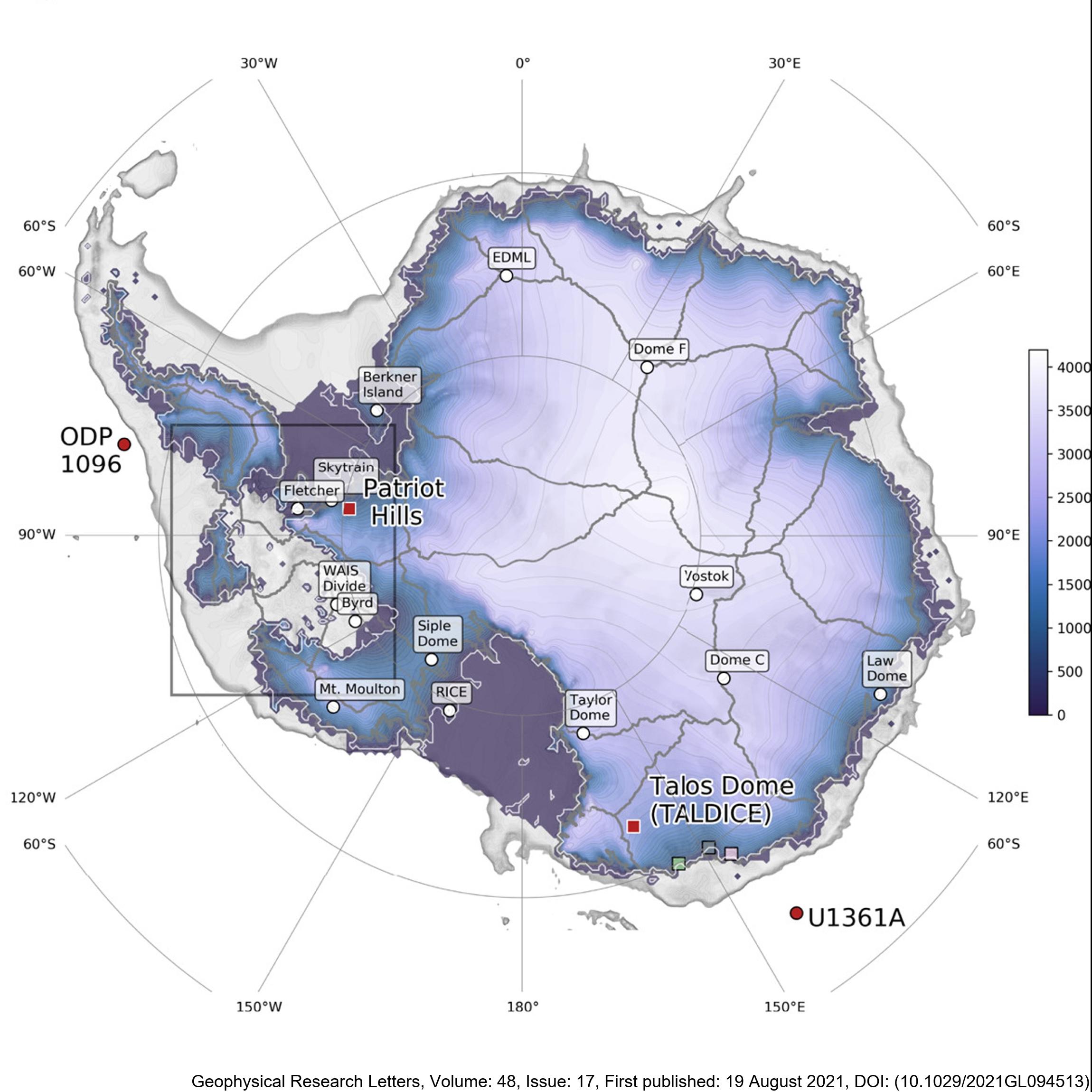
Here, we present new, transient, GCM-forced ice-sheet simulations validated against proxy reconstructions. This is the first time such an evaluation has been attempted. Our empirically constrained simulations indicate that the AIS contributed 4 m to global mean sea level by 126 ka BP, with ice lost primarily from the Amundsen, but not Ross or Weddell Sea, sectors. We resolve the conflict between previous work and show that the AIS thinned in the Wilkes Subglacial Basin but did not retreat. We also find that the West AIS may be predisposed to future collapse even in the absence of further environmental change, consistent with previous studies. There are two files, for Termination 1 ('T1') and Termination 2 ('T2'). They contain spatial fields for ice thickness, ice surface elevation, bedrock elevation, surface and basal velocity, and mask. The T1 outputs are every 500 years, whereas the T2 outputs are every 100 years. The spatial resolution of both is 20 km. Sea-level-equivalent mass loss can be calculated from these outputs, but is also provided here in a text file for convenience. RELATED PUBLICATION: Golledge, N.R., Clark, P.U., He, F., et al. (2021). Retreat of the Antarctic Ice Sheet During the Last Interglaciation and Implications for Future Change. Geophysical Research Letters, 48(17). https://doi.org/10.1029/2021GL094513 GET DATA: https://doi.org/10.17605/OSF.IO/GZB3H